Die Ingenieurgeologie ist ein interdisziplinäres Arbeitsgebiet zwischen den klassischen Geowissenschaften und dem Bauingenieurwesen. Als Teil der Angewandten Geologie und Geotechnik, befasst sie sich mit den mechanischen und physikalischen Eigenschaften des Untergrundes entsprechend den genetisch bedingten Materialeigenschaften und ihrer erdgeschichtlichen Entwicklung. Damit erarbeiten wir ein realitätsnahes Baugrundmodell für die Planung und Realisierung von Bauvorhaben, Sanierungs- oder Sicherungsmaßnahmen. Die Basis hierfür bilden Eigen- und Fremderkundungen des Untergrundes jeglicher Art, Kartenwerke, Kartierungen, interne und externe geologische und hydrogeologisch Datenbanken sowie langjährige Erfahrungen unserer Ingenieurgeologen und Ingenieurgeologinnen.
Planung der Baugrunderkundung
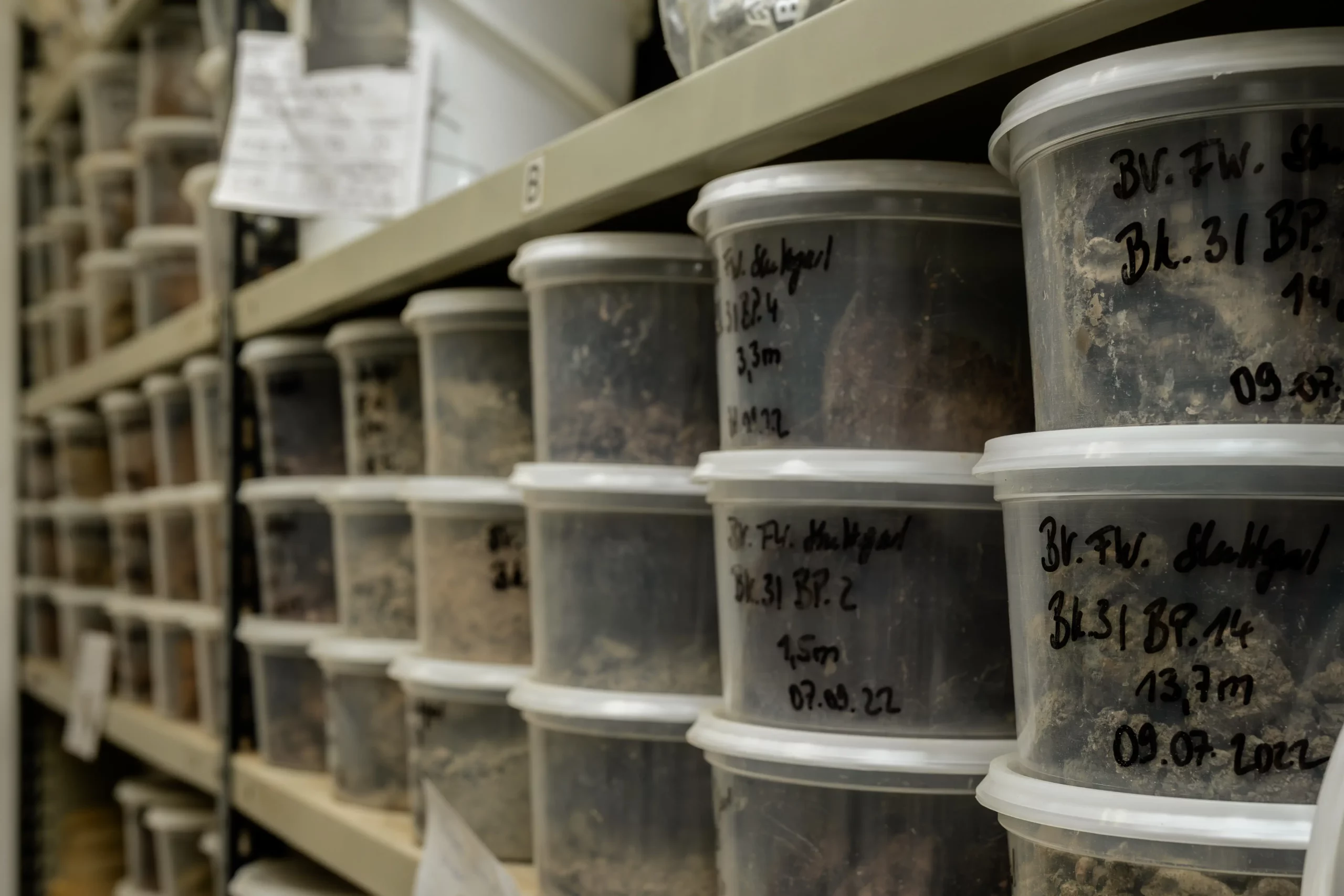
Die Baugrunderkundung ist eine wichtige Grundlage für die Erstellung eines möglichst realitätsnahen Baugrundmodells. Die Erkundungsergebnisse werden in einem Geotechnischen Bericht zusammengefasst. Der Geotechnische Bericht beschreibt die angetroffenen Baugrund- und Grundwasserverhältnisse, legt charakteristische Kennwerte für erdstatische Berechnungen fest und macht bautechnische Angaben u. a. zur Gründung, zum Erdbau, zur Wasserhaltung und zu den Baugruben.
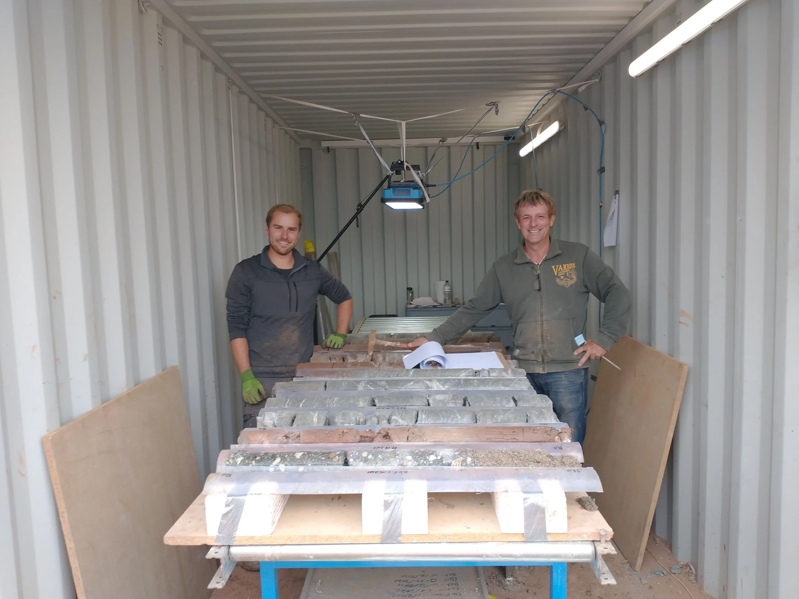
Von der Qualität der Baugrunderkundung und des darauf aufbauenden geologisch-geotechnischen Baugrundmodells hängt die spätere geotechnische Beratung ab, die sowohl sicher, als auch wirtschaftlich sein muss. Deshalb erfolgt bei und die Durchführung und Überwachung der Baugrunderkundung sowie die ingenieurgeologische Ansprache des Bohrguts und die Bewertung der Untersuchungsergebnisse ausschließlich durch erfahrene GeologInnen und GeowissenschaftlerInnen.
Boden- und felsmechanische Versuche sind erforderlich, um die in der geotechnischen Erkundung angetroffenen Böden und Gesteine mit Hilfe objektiver Vergleichswerte boden- und felsmechanisch klassifizieren, Homogenbereiche gemäß VOB definieren und charakteristische Werte für erdstatische Berechnungen festlegen zu können.
Die Ergebnisse einer geotechnischen Untersuchung müssen in einem Geotechnischen Untersuchungsbericht nach DIN EN 1997-2 und DIN 4020 zusammengestellt werden. Der Geotechnischen Bericht muss darüber hinaus die Bewertung der Ergebnisse des Untersuchungsberichtes, die Gründungsempfehlung sowie die Folgerungen für das Bauwerk und die Ausführung enthalten.
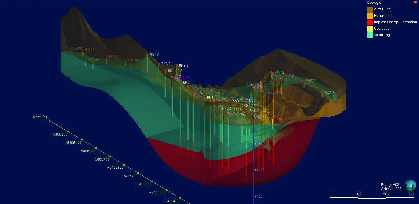
In der Projektabwicklung gewinnt die Arbeitsmethode des sogenannten „Building Information Modelings“, kurz BIM, zunehmend an Bedeutung. Die meisten Baumaßnahmen greifen in den Untergrund ein. Damit stellt der Baugrund einen Teil des Gesamtmodells BIM dar. Die Visualisierung des Baugrunds erfolgt als dreidimensionale digitale Modelle, die in das Gesamtmodell implementiert werden. Dadurch wird es möglich, die Nutzung der Baugrundinformationen für alle Beteiligte effizienter und transparenter zu gestalten.
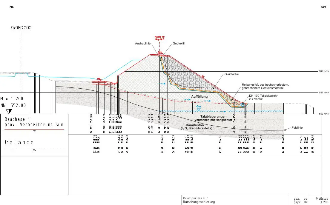
Durch den Klimawandel und den damit einhergehenden extremen Wetterereignissen wie Starkregen oder Trockenperioden steigt die Gefahr von Georisiken. Darüber hinaus werden durch die Erschließung von neuen Baugebieten für den Wohnungs- und Industriebau sowie für Infrastrukturmaßnahmen zunehmend Flächen in Anspruch genommen, die bisher aus gutem Grund nicht bebaut wurden, wie zum Beispiel Talauen mit weichen Böden oder Überflutungsflächen, Rutsch- oder Kriechhänge, Karst- oder Felssturzgebiete.
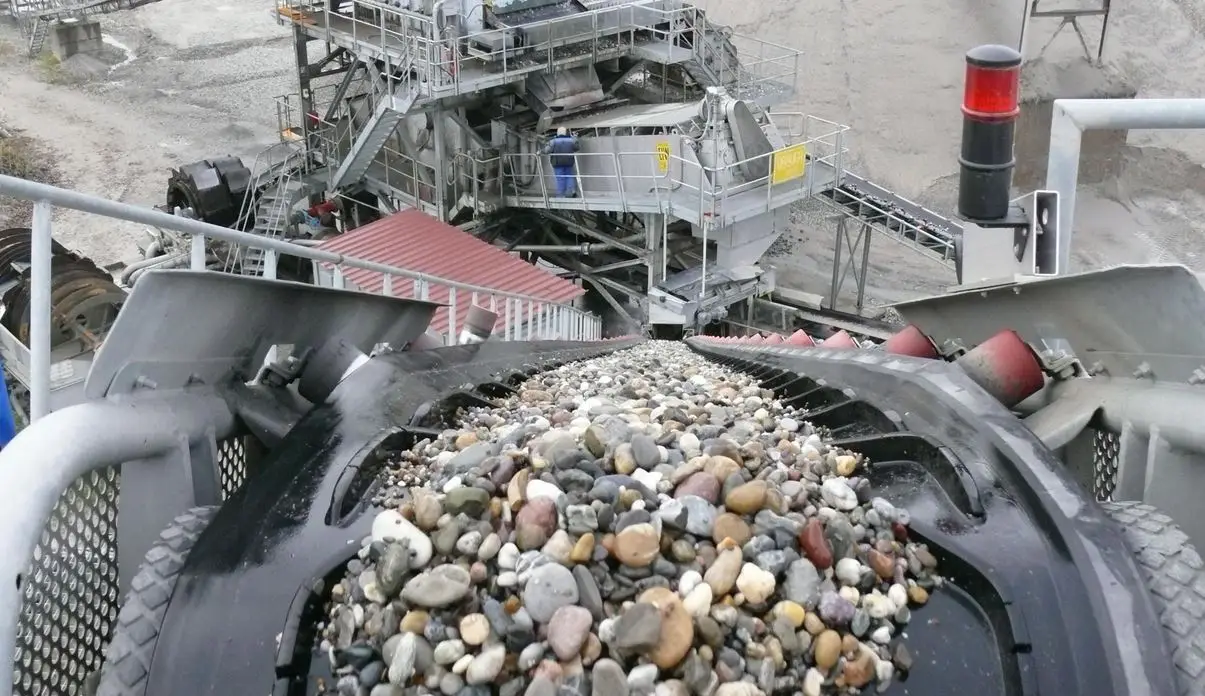
Als Lagerstätten bezeichnet man Bereiche der Erdkruste, in denen sich feste, flüssige oder gasförmige Rohstoffe in einer hohen, natürlichen Konzentration befinden. Wir beraten in erster Linie zu mineralischen und nichtmineralischen Lagerstätten, die entweder oberirdisch im Tagebau oder unter Tage mit Schächten und Tunneln erschlossen werden.